Northshore Acreage Buyer Guide: Land Due Diligence in St. Tammany Parish
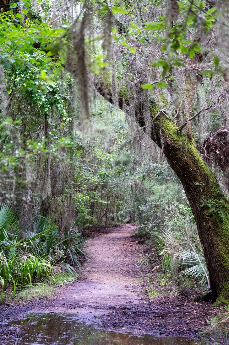
Photo: Shane Carr. CC BY 2.0. Source: Wikimedia Commons.
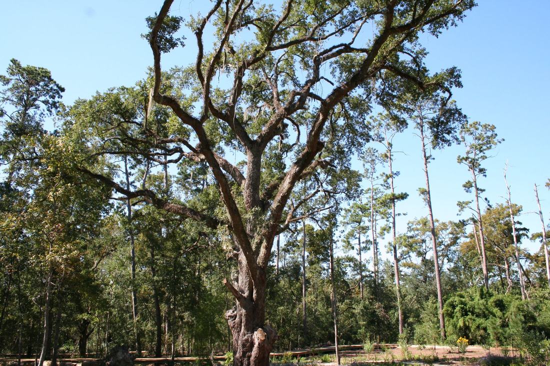
Photo: St. Tammany Parish Government. CC BY 2.0. Source: Wikimedia Commons.
Buying land on the Northshore is different from buying a house in a subdivision. The survey, the road in, the soil, the water and the paperwork matter as much as the view. Cynthia "Cyndi" Benbow, DVM, a licensed real estate agent and REALTOR® with eXp Realty, LLC helps buyers and sellers with acreage in St. Tammany Parish, from wooded homesites near Covington to pasture around Folsom and Bush. This guide is the checklist she works through before a land offer goes firm.
It is not legal or tax advice. Bring a surveyor, a title company or Louisiana attorney, and a CPA.
1. Survey and Boundaries
Order a current boundary survey. It should show the corners, fences, buildings, servitudes, pipelines, power lines and any encroachments. Old fences often do not match the legal line.
2. Legal Access
Confirm the parcel touches a public road or has a recorded right to cross a neighbor's land, called a servitude of passage in Louisiana. A driveway used for years is not the same as a recorded servitude. Ask the parish whether the road in front is on the parish maintenance system or is a private road someone else must keep up.
3. Who Zones the Land, and Can It Be Split?
Find out whether the parcel is inside a town or city or in unincorporated St. Tammany Parish. For parish land, the Unified Development Code applies. Start with St. Tammany Planning & Development. Ask:
- What is the zoning district, and is there a Rural Overlay?
- Is the parcel above the parish's Urban Growth Boundary? That line affects what can be built and how.
- Can the tract be divided, and what review does a land split need?
- Is the land part of an older "paper subdivision" platted decades ago? The UDC treats lots in subdivisions recorded before 1970 differently. Ask whether each lot is buildable.
For livestock and barns, see St. Tammany horse property rules.
4. Flood Zones and Wetlands
Check every part of the tract, not just the house site, on FEMA's Flood Map Service Center and the U.S. Fish & Wildlife Service National Wetlands Inventory. Creeks, low pasture and pine flats can carry wetlands that need a U.S. Army Corps of Engineers permit before they are filled or built on. A wetland delineation by a qualified consultant can answer the question for your plans.
Phase I and Phase II Environmental Site Assessments
A wetland delineation and an Environmental Site Assessment answer different questions. The first maps wetlands and helps you understand whether the U.S. Army Corps of Engineers has a say in fill or construction. The second looks for possible contamination. They are separate studies, done by different consultants, and both should be started during the contract's due diligence and inspection period.
This section is general information, not legal, tax, engineering, or environmental advice. Talk with a qualified environmental professional and a Louisiana attorney about the land you are considering. Cynthia Benbow, DVM, is a licensed real estate agent and REALTOR® with eXp Realty, LLC. She is not an environmental professional, and this guide is not a Phase I or Phase II report.
What a Phase I ESA is
A Phase I ESA is a records-and-inspection study. It is not soil or water sampling. A qualified environmental professional reviews historical sources and government records, visits the property and adjoining land, interviews owners, operators, or occupants, and writes a report. The report says whether the professional has found a recognized environmental condition (REC): a past, current, or threatened release of hazardous substances or petroleum that could affect the property.
The current national standard for that work on commercial real estate is ASTM International E1527-21. For large forestland or rural property, ASTM E2247-23 may be used instead. The U.S. Environmental Protection Agency's All Appropriate Inquiries (AAI) rule, at 40 CFR Part 312, treats those standards as consistent with AAI.
AAI matters because federal Superfund law (CERCLA) can attach cleanup liability to a current owner even if that owner did not cause the contamination. Completing AAI before you acquire the property is one of the threshold steps for certain landowner liability protections, including the innocent landowner, bona fide prospective purchaser, and contiguous property owner protections. Those protections have other legal requirements besides the Phase I. A Louisiana attorney should explain what applies to your purchase.
ASTM notes that a Phase I is not customary for someone buying a dwelling for their own residential use. On Northshore acreage, it is still worth discussing with your lender, your attorney, and an environmental professional if the tract has tanks, pits, dumps, old farm or timber-chemical storage, or a history of oil and gas.
How long a Phase I stays usable
Under the AAI rule and ASTM E1527-21, the clock is not the date on the cover of the report. It is the date each required piece of work was finished. AAI must be completed within one year before the date you acquire the property. These five pieces must be completed or updated within 180 days before acquisition: interviews with past and present owners, operators, and occupants; a search for recorded environmental cleanup liens; review of federal, tribal, state, and local government records; visual inspection of the property and adjoining properties; and the environmental professional's declaration. If closing slips past those windows, parts of the Phase I, or the whole study, may need to be updated.
What a Phase II ESA is
If the Phase I finds a REC, or if a lender or the environmental professional recommends more work, the next step is often a Phase II ESA under ASTM E1903-19. A Phase II is a scoped sampling investigation of soil, groundwater, or soil vapor. It is not automatic after every Phase I, and it is not a cleanup plan.
The current Louisiana residential and vacant-land purchase forms both say that all testing shall be nondestructive. A Phase I site visit is typically visual. Phase II drilling, borings, or wells are intrusive. Get the seller's written permission, and have your attorney review access, restoration, and liability language, before any Phase II fieldwork.
When buyers and lenders typically ask for one
A Phase I is customary on many commercial purchases and commercial loans. For SBA 7(a) and 504 loans, SOP 50 10 8.1 (effective October 1, 2026) requires an environmental investigation of commercial property offered as collateral. A Phase I must start that investigation, regardless of loan amount, if the property's current or known prior use matches an environmentally sensitive industry in Appendix 6, such as oil and gas extraction, gasoline stations, or dry cleaning. If there is no such match, a loan of more than $250,000 starts with a questionnaire and a records search with risk assessment; a result other than "low risk" leads to a Phase I. If the Phase I professional says more investigation is warranted, typically a Phase II, the lender must follow that recommendation or seek an SBA exception. Confirm the current SOP and your lender's checklist.
Growing timber or running cattle does not, by itself, put a tract on that SBA list. What often does raise the question on Louisiana acreage is a former tank battery, pit, pipeline, well, farm dump, pesticide or chemical storage, or an underground tank.
Louisiana records to check
Ask the environmental professional to review Louisiana Department of Environmental Quality records in the Electronic Document Management System (EDMS), and to search SONRIS — the public portal of the Louisiana Department of Conservation and Energy, including the Office of Conservation — for wells, including orphan wells, and water wells. See the Department's SONRIS Guides.
The Department's Orphan Wells FAQ says Louisiana has approximately 6,000 orphan wells, that the state does not assume ownership of the well or the land, and that "the owner of the property on which an orphaned site is located is not responsible for site restoration." That is the state's published FAQ, not a legal opinion about your tract. Pits, spills, equipment, or a buyer who later takes on operator duties can raise different issues. Have a Louisiana attorney and an environmental professional review what the records and a site walk actually show.
Typical cost and timeline
There is no official Louisiana fee schedule. These are published ranges from environmental firms and industry articles in 2025 and 2026, not a quote for any Northshore tract. Get a written proposal from a qualified environmental professional who will follow the current ASTM standard.
- Phase I (no sampling). Aegis Environmental (June 4, 2025) published a 2024–2025 average range of $2,150 to $5,000 for a standard commercial property, with higher costs possible for large acreage or a long use history, a standard timeline of 2 to 4 weeks, and rush service of 1 to 2 weeks, typically at a 20 to 50 percent surcharge (source). ESA Inspections (updated September 2026; Southern California figures) published $2,000 to $6,000 typical, with vacant land or a small lot at $2,000 to $3,000, and a standard turnaround of 10 to 15 business days (source).
- Phase II (sampling; the price depends on scope). Aegis Environmental (October 8, 2025) wrote that a Phase II with sampling only and no drilling typically costs $2,000, which it called uncommon; that a subsurface investigation typically costs $8,000 to $12,000 and is often higher; and that many projects finish in about 2 to 4 weeks (source). ESA Inspections (September 2026; Southern California figures) published $5,000 to $30,000 as a typical range, with monitoring wells or complex sites often $30,000 to $75,000 or more, and a typical timeline of 3 to 6 weeks (source). LoanGuys (February 3, 2025) published $8,000 to $15,000 for most commercial properties, and $25,000 to $100,000 or more for large or highly contaminated sites (source).
If a Phase I finds a REC, plan for the Phase II time in addition to the Phase I time.
How this works with Louisiana purchase agreements
The length of the due diligence window is whatever the parties write into the contract. It is not a fixed number of days set by statute.
- For residential property of one to four dwelling units, licensees must use the form prescribed by the Louisiana Real Estate Commission. See La. R.S. 37:1449.1. The current mandatory form is the 2026 Louisiana Residential Agreement to Buy or Sell (Rev. 01/2026), on the Commission's Forms page. Its Due Diligence and Inspection Period starts on the first day after acceptance and ends the agreed number of calendar days after that start, or when the seller receives the buyer's written request, whichever is earlier. If the buyer does not terminate or send that request before the period expires, the buyer is deemed to have accepted the property's current condition. The form allows inspections and other due diligence at the buyer's expense, and it states that all testing shall be nondestructive.
- For vacant land, the Commission publishes a Sample Purchase and Sale Agreement for Vacant Land. That form is a courtesy "Other" form, not a mandatory form. Its Due Diligence and Inspection Period also starts the first day after acceptance and runs the number of calendar days the parties fill in. It expressly allows engineering, topographic, soils, zoning, wetlands, and environmental inspections, and other assessments or evaluations, at the buyer's expense. It also states that all testing shall be nondestructive.
- For commercial property that is not "residential real property" under that statute, the Commission does not prescribe a mandatory purchase agreement. Those contracts are typically drafted or reviewed by a Louisiana attorney and include a negotiated due diligence period.
Because a Phase I often takes two to four weeks, and a Phase II can take several more, many land buyers need a longer Due Diligence and Inspection Period than they would on a house in a subdivision, plus written permission if sampling will be done. Start the environmental professional and the wetland consultant as soon as the agreement is accepted. Do not let the period expire, and do not waive it, before you have the reports you bargained for, or a written extension.
How this relates to wetland delineation
A Phase I may mention wetlands as a business issue, but it does not delineate wetlands and does not decide Corps jurisdiction. A clean Phase I does not tell you whether you can fill, clear, or build in a wet part of the tract. A delineation does not tell you whether the soil or groundwater is contaminated.
A wetland delineation is done by a qualified wetland consultant using the 1987 Corps of Engineers Wetland Delineation Manual and the Atlantic and Gulf Coastal Plain supplement, and it should be tied to a surveyed plat. A jurisdictional determination is the U.S. Army Corps of Engineers, New Orleans District's decision about whether, and where, it has authority. A JD is not a permit to fill or build. Discharge of dredged or fill material into waters of the United States, which can include wetlands, is regulated under Section 404 of the Clean Water Act. See the District's Regulatory page. Order both studies when both questions matter, and start both during the same due diligence period.
5. Septic and Soil
Most rural homes on the Northshore use individual septic systems. A new system needs a permit from the Louisiana Department of Health, which looks at the soil and drainage first. Ask for the permit and service history of any existing system and have it inspected. If you plan to build, ask what system the soil will support before you close.
6. Well Water
Have the well tested for water quality and flow. Ask its depth and age, and whether there is a backup plan for water during power outages.
7. Title and Mineral Rights
In Louisiana, mineral rights can be held separately from the land and can lapse after years of nonuse under the state's Mineral Code. Have a title company or Louisiana attorney check what minerals, timber rights and servitudes come with the sale, and whether any oil, gas or pipeline agreements are recorded.
8. Timber
Ask about timber stands, past harvests and any timber contract that is still in force. A forester can estimate merchantable timber.
9. Agricultural, Horticultural and Timber Use Value
Louisiana allows qualifying agricultural, horticultural, timber and marsh land to be assessed at "use value" instead of market value. A new owner must apply with the St. Tammany Parish Assessor. Ask the assessor about the rules and deadlines and talk with a CPA.
10. Utilities and Internet
Confirm power at the road, the cost to bring it in, and internet service at the exact address. Rural service can vary from one road to the next.
11. A Veterinarian's Eye on the Land
Cyndi is a veterinarian, so on a land tour she also looks at drainage after rain, pasture quality, fencing, shelter, water for animals and access for a truck and trailer. For a full horse-facility checklist, see the Folsom equestrian guide. Bring your own large-animal veterinarian for any animal question.
Where Northshore Acreage Buyers Look
- Folsom and the northwest parish: pasture, horse farms and nurseries. See the Folsom guide.
- Bush and Sun: timber and hobby-farm country.
- Lacombe: bayou and wooded lots near the refuges. See the Lacombe guide.
- North of Covington and Abita Springs: wooded homesites and small farms.
- Pearl River: acreage near Interstate 59.
Schools
Public schools are run by the St. Tammany Parish School Board. Check the assigned schools for any address with the district's official Find Your School tool.
Selling Land
Land buyers ask for the survey, access, flood zone, wetlands, utilities and use-value status first. Cyndi gathers them before you list, prices from comparable land sales, not house sales, and markets with aerial photos and video, boundary-overlay maps and a dedicated property web page. Private, NDA-based service is available.
BenbowIQ™ Market Tools for Northshore Acreage
Cyndi's BenbowIQ™ tools use public market data and name their sources and dates. They show area trends. They do not value any one home.
- Market Pulse: type a rural ZIP such as 70437 (Folsom), 70431 (Bush), 70445 (Lacombe) or 70452 (Pearl River) to compare with St. Tammany Parish, Louisiana and the U.S.
- Price Map: see the rural ZIP codes next to Covington, Mandeville and Slidell.
- Rate Tracker: the 30-year mortgage rate next to St. Tammany Parish home values over time.
- Home Value: ask Cyndi for a comparative market analysis of your land or farm.
- Market Watch: a short monthly email update for St. Tammany Parish or your ZIP code. Unsubscribe any time.
More: Land & Ranch · Folsom guide · Folsom equestrian guide · St. Tammany horse property rules · Lacombe
Northshore Acreage Questions
What should I check before buying acreage on the Northshore?
A current survey, legal road access, who zones the land and whether it can be split, flood zones and wetlands across the whole tract, septic and soil, the well, title and mineral rights, timber, use-value status, utilities at the address, and, when the land's history or the lender calls for it, a Phase I Environmental Site Assessment.
Do I need a permit for a septic system on rural St. Tammany land?
Yes. A new individual sewage system needs a permit from the Louisiana Department of Health, which evaluates the soil and drainage first. Ask for the history of any existing system and have it inspected.
Can I split a tract of land in St. Tammany Parish?
Possibly. It depends on the zoning, any overlay, the Urban Growth Boundary and the parish's subdivision review. Ask St. Tammany Planning & Development before you buy, and get the answer in writing.
Do mineral rights come with land in Louisiana?
Not always. Mineral rights can be held separately from the land and can lapse after years of nonuse under the state's Mineral Code. Have a title company or Louisiana attorney check what transfers.
Can Cyndi help me sell acreage on the Northshore?
Yes. She gathers the survey, access, flood, wetlands, utility and use-value details buyers ask for, prices from comparable land sales and markets with aerial photos, video and boundary maps.
Talk With Cyndi About Northshore Land
Call or text Cyndi at 504.301.5850 to set up a private consultation, or request a comparative market analysis.
Private Tours by Request: Private, blacked-out SUVs with professional drivers and a dedicated concierge are available for private home and property tours and area orientations, by request only. All arrangements are confirmed with you in advance, and every driver and concierge team member is available to sign a non-disclosure agreement.
Photo credits
Photos on this page are used under the licenses below. CC BY and CC BY-SA works require this credit. Share-alike licenses also require that adapted copies of those photos stay under the same license.
- Hero photo (An unpaved road through woods with Spanish moss in Nott, St. Tammany Parish, Louisiana): Shane Carr. CC BY 2.0. File page on Wikimedia Commons.
- Supporting photo (A live oak and pine woods at Camp Salmen Nature Park in St. Tammany Parish, Louisiana): St. Tammany Parish Government. CC BY 2.0. File page on Wikimedia Commons.


Official area information: St. Tammany Parish Government.